
How a Ventura Street Directory Search Begins
Read one address at a time. A street-wide scan is a spatial project, not a button that returns every person on a road. Begin with the City of Ventura address checker when the property appears to be inside city limits. Confirm the same location in County View, because its locator searches both parcel and street databases and can return several candidates. The first match is not always the right parcel.
Once the situs and APN are stable, follow the evidence chain. Ownership belongs with assessment and recorded documents. Building history belongs with the city or county permit custodian. Occupant clues come from historical directories, census schedules, or a lawful voter-file channel. Keep each role labeled so a contractor, agent, owner, voter, or householder is not silently turned into a resident.
- Run the street number and core street name through the City of Ventura address checker when the address is within the city.
- Enter the same address in Ventura County View, review candidate results, and save the APN and exact situs spelling.
- Use the lawful Assessor route to establish the assessment owner or claimant, while keeping the mailing address separate from the situs.
- Search the Ventura County Recorder's Grantor/Grantee index by party name and document clue, then bridge each deed to the APN and legal description.
- Use permits, reverse directories, census schedules, and other historical sources to test occupancy instead of treating ownership as a household roster.
County View Fields for Ventura Streets
The County View address locator is the core map tool for a Ventura street directory. The official guide describes a number field, a street-name field, optional direction, a Locate button, a result list, and a Zoom to action. APN search and map browsing provide a second path when an address is old, ambiguous, or tied to a parcel map. The map also carries layers for parcels, aerials, zoning, record maps, schools, political districts, and city boundaries.
| Field or control | Type | How to use it |
|---|---|---|
| Address number | Text | Enter the street number before locating a parcel |
| Street name | Text | Use the core name; the suffix can be optional |
| Prefix or direction | Text or selector | Add N, S, E, or W when a road has competing matches |
| Locate | Button | Open the result list and map view |
| APN or parcel mode | Search mode | Use a nine-character parcel key or formatted APN clue |
| Layer controls | Expandable checkboxes | Turn on parcels, boundaries, record maps, zoning, or aerials |
Click the correct candidate before recording a parcel. A postal Ventura address can fall outside the incorporated city, and an institutional ZIP can differ from the street-delivery ZIP nearby. County View helps with that jurisdiction check, while the parcel geometry gives the street directory its map spine.
Ventura Street APN and Situs Clues
The Assessor's form separates property location from the owner's mailing address. That distinction matters on every Ventura street directory search. Situs identifies the land or improvement being assessed. Mailing tells the county where notices and tax bills should go. The two may match, but they may also point to different places. A mailing match does not prove that the owner lives at the parcel, and a parcel map does not list every household member.
The public parcel schema adds continuity clues: APN and status, situs components, tract, map number, document number and date, zoning, acreage, book, page, block, parcel, and assessment-purpose fields. The open GIS layer inspected for Ventura does not show owner or mailing fields. Use County View to place the property, then use the lawful Assessor and Recorder channels for names and instruments.
- Parcel
- A mapped unit of land with an APN and geometry, which may differ from a single dwelling or household.
- Situs address
- The physical address tied to the assessed parcel or improvement.
- Plat or record map
- A recorded map that gives subdivision, lot, block, or parcel context.
- Criss-cross directory
- A reverse listing that may move from street address to a named householder when a volume contains that section.
For current ownership clues, use the Ventura County Assessor property-search route and preserve the APN even when owner-name display is limited. That key can be checked against later documents.
Ventura Records Available by Street
A Ventura street directory works best as a chain of address-keyed records. Each set reveals a different layer, and some use a name or APN rather than a street string. The coverage table shows what can be observed and what remains an inference.
| Record set | Keeper | Street-level use | Access |
|---|---|---|---|
| Parcel and assessment data | Ventura County Assessor and GIS | APN, situs, parcel shape, assessment clues | Property and map portals; owner fields follow lawful access rules |
| Recorded deeds and liens | Ventura County Clerk-Recorder | Grantor, grantee, recording date, legal description, prior transfer | Grantor/Grantee index, counter, mail or email guidance; current cutoff unverified |
| City permit history | City of Ventura Permit Services | Permits, microfiche permits, sewer-lateral reports, project roles | Free public portal for city addresses; counter and request fallback |
| County land-use permits | Resource Management Agency | Permit status and documents outside city jurisdiction | VC Citizen Access public search |
| Historical directories | Libraries and archives | Named householders, addresses, occupations, reverse entries if present | State Library, County Library, Museum appointments and catalog help |
| Census through 1950 | Federal census collections | Household enumeration on a census date | Library workstations and genealogy collections; boundary checks needed |
The address is the entry point, but the APN and document number are stronger bridges. A street name alone can cross a city boundary, ZIP, tract, or historical spelling. Keep source date and record role beside each row in any street table.
Ventura Permit History by Address
Ventura Permit Services says recorded permit history for an address within city limits is available through its Public Records Access Portal. The online set includes permits, microfiche permits, and private sewer-lateral reports, and searching and printing are free. The Room 117 counter can help with a missing file. Walk-in hours are Monday through Thursday from 8 a.m. to 1 p.m.; appointments run from 1 to 3 p.m., and Friday is closed.
Permit metadata can name an owner, applicant, contractor, architect, or engineer. Those roles must stay attached to the name. A permit dates work or a request; it does not prove that the named person occupied the property. Archived architectural and construction plans may be viewed when retained, but California Health and Safety Code section 19851 restricts copying without authorization from the property owner and design professional.
The Ventura building-record search page explains the address lookup and the separate My Ventura Access request route.
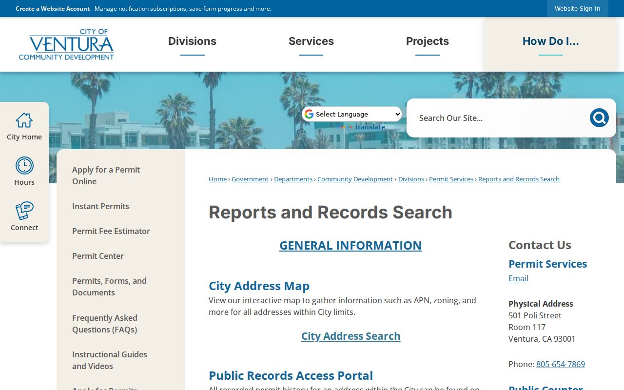
The screen is valuable for a house-history timeline because it keeps city permit history tied to an address, even when plan sheets cannot be copied.
Ventura Deeds Along a Street
Recorded documents are indexed mainly by party names and document metadata, not by a durable street address. Start with the current APN and the lawful assessment owner, then search that person as a grantee. Read the acquisition instrument for grantor, document number, recording date, vesting names, and legal description. Search the earlier grantor as a grantee and repeat. Trust names, spelling changes, subdivisions, unit changes, and street renumbering can break a plain address search.
The exact current online cutoff and present image and copy fees were not verified. Historical county material confirms computerized and microfiche grantor-grantee products for 1968 through 1988, but that does not prove the present web index begins in 1968. When the online trail stops, use the Ventura Government Center counter, phone 805-654-3665, or the recorder's general email for access guidance. Earlier books and microfiche are a normal fallback, not evidence that the parcel has no past.
The Ventura County Recorder Grantor/Grantee Search is the named starting point for the party index.
Use the index as a finding aid, then inspect or order the recorded instrument before treating a party name as evidence about a street.
Ventura Reverse Directories for Occupants
Ownership and occupancy diverge. A historic city directory or telephone book can add a person and address that a deed cannot, while a deed can explain why the property changed hands without naming every household. The California State Library points researchers to specialized City Directories and Telephone Books databases. Ventura County Library supplies local-history books and microfilm, and the Museum Research Library can search its appointment-only holdings.
When a volume has a reverse or criss-cross section, transcribe the complete printed address and then confirm the same name in the alphabetical section. Check adjoining numbers, spouse marks, occupation, and any “removed to” notation that the publisher uses. The exact Ventura publisher run and abbreviation key remain unresolved, so do not assign a year or mark to a local entry without seeing the title page and volume instructions. The historical shelf has its own reading method on the Ventura city directory collections page.
Ventura's Pierpont Court and Lane Shift
Ventura's Pierpont neighborhood shows why a street directory needs historical map context. The Frank Meline Company subdivided the area in 1925 during the oil-boom growth period. Carleton M. Winslow Sr. designed homes facing pedestrian Courts while cars used rear Lanes. In the early 1950s houses were reoriented toward the Lanes. During late-1960s annexation, the fifteen-foot Courts were closed and transferred to adjacent owners, followed by new construction in the 1970s.
A search for a modern street label can therefore miss a past occupant even when the parcel is the same. Test both Court and Lane labels in directories, permits, newspapers, maps, and deed descriptions. Compare the APN, tract, record map, and building footprint before deciding that a name disappeared. This local quirk is a practical reason to pair a street-by-street search with historic maps.
Ventura ZIP and Voter Checks
A personal voter-status check is not a street directory. California My Voter Status is meant for a person checking their own registration. A broader voter-file product needs a qualified purpose and application review, and it can include residence address, status, precinct, district, and participation history only within the approved product. It never shows ballot choices and does not enumerate unregistered people.
ZIP codes add another boundary check. Ventura's ordinary city-service ZIPs are 93001, 93003, and 93004, while 93009 is used by the Government Center and 93002, 93005, 93006, and 93007 need USPS confirmation before being mapped as ordinary residential geography. Use the full address in USPS ZIP Lookup, then confirm the city line and parcel jurisdiction in City Find or County View. A ZIP label should not decide which records office holds a street record.
What a Ventura Street Directory Cannot Show
No public source inspected for Ventura lists every person who sleeps at an address. The parcel layer shows land. The Assessor shows assessment-purpose ownership or control through its lawful channel. A deed shows a transfer. A permit shows a project and its named roles. A directory shows only people the publisher chose to list. Renters, children, guests, unregistered household members, utility customers, delivery recipients, and protected participants may not appear at all.
California DMV residence data is restricted by the federal Driver's Privacy Protection Act. Safe at Home can substitute a confidential mailing address for eligible participants. Voter data has statutory purpose and field limits. A missing name is therefore a boundary of the source, not permission to infer a private fact from a different record.
Lawful use. Ventura street and address records are for personal, lawful research such as family history, property history, civic review, or safe reconnection. Using them to stalk, harass, intimidate, impersonate, or harm anyone can violate California law.